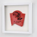
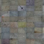
.Litter Landscapes is a series of screen prints on trash collected from New York City sidewalks, particularly in my neighborhood where there aren’t many public garbage cans. I print drawings I’ve made of plants with melancholic names—Blue Violets and Bleeding Hearts, Depressed Clearweed and Weeping Brown Sedge—on this ordinary debris, matching the color of the […]
Rock Records
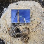
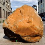
. Rock Records are photo-installations of monumental boulders set in relationships with each other and with small-scale inset images, which deepen the conversation for the viewer up close. The visual language includes rocks, construction debris, and trash bags. Weirdly, at a certain distance, they all resemble each other. The work interrupts and re-layers geological presence […]
Struve was an astronomer who looked at the ground
I visited Tartu, Estonia with a plan to explore it according to the Struve Geodetic Arc. As I wandered the city, I wondered about Friedrich Georg Wilhelm Struve himself, who mapped this chain of points that accurately measured the size and shape of the Earth for the first time. He was both an astronomer and […]
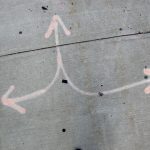
Stop carrying out your intentions and watch for my signals
Sidewalk Signal Code, 2017-2018: A series of signal code flags, gesturing towards the sea and sidewalk
Astronomy of the Asphalt Ecliptic
Astronomy of the Asphalt Ecliptic, 2017: A series of signs charting the constellations of Las Vegas and revealing visible and invisible phenomena in the surrounding city
Street Signs Became Flags That Mark Mountaintops
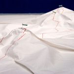
Street Signs Became Flags That Mark Mountaintops, 2012-2013: An expedition through New York City as a series of mountain climbs
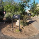
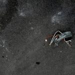
Visitor Center for Erratic Monuments
Visitor Center for Erratic Monuments, 2013-2015: An resource for interpreting peculiar boulders found along Brooklyn sidewalks
Landmarks

Landmarks, 2008-: An ongoing series of photographs of discovered landmarks
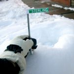
A sign marks a summit

A sign marks a summit, 2012: A self-guided trail which wandered the grid of Peekskill, NY’s sidewalks, streets, longitude and latitude up to a local summit
A summit is a local point of elevation
A summit is a local point of elevation, 2011: Maps an expedition to the mountain peaks of Crown Heights, Brooklyn
Sidewalk Drawings
Sidewalk Drawings, 2008-2013: Cracks in the sidewalk are collaged together to create a destinationless, meandering path through an imagined city landscape
Public Utility Trail Network
Public Utility Trail Network, 2010-2011: Maps re-interpreting the marks left by public utilities as trail markers in a network of hiking/walking trails for pedestrians
Local Landmarks

Local Landmarks, 2010: A pair of guidebooks to USGS survey monuments of varying scale
Brooklyn Constellations

Brooklyn Constellations, 2007: A map of all the businesses in the local phonebook that begin with the name “star”
Big Bang and other theoretical topography
Big Bang and other theoretical topography, 2006-2008: A series of videos and photographs made with images by the Mars Rovers, Hubble Space Telescope, and the history of the universe in mind
Proposals for…

Proposals for…, 2005-2006: I made temporary tattoos of natural, physical phenomena and attempted to put them to use while navigating the city
One step is 3.6 million miles

One step is 3.6 million miles, 2005: A walking tour of the solar system along a sidewalk in DUMBO, Brooklyn